Release Notes 24/02/22
1. Import with Attributes
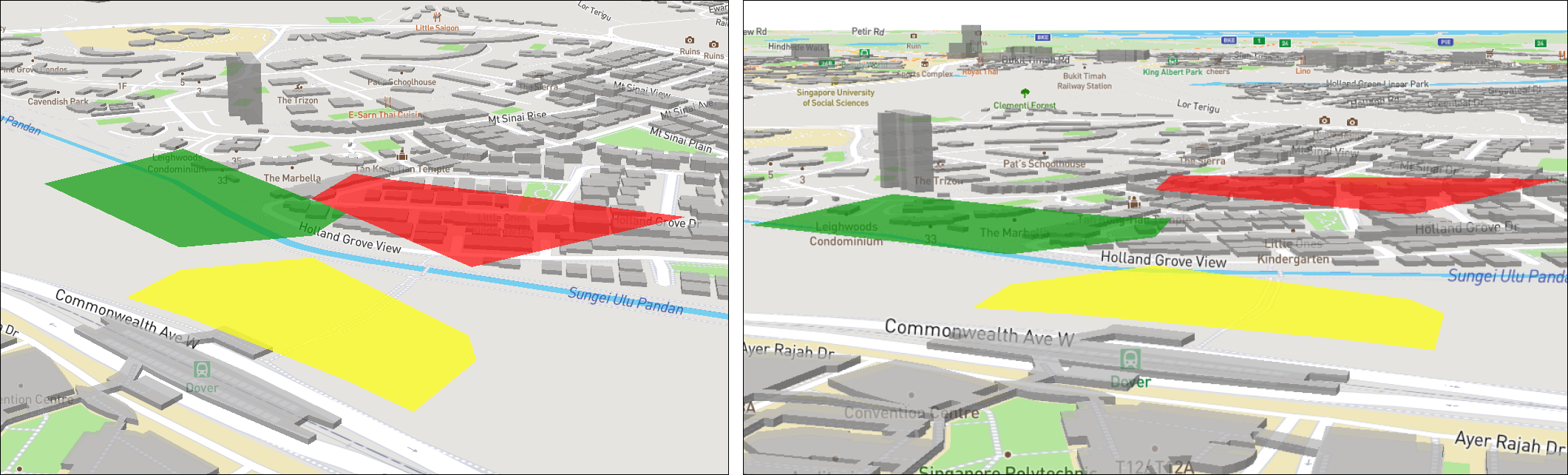
a. Import polygons, networks, terrains, and points with additional attributes.
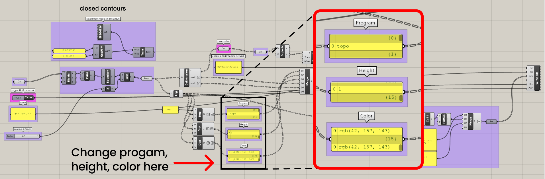
- Export polygons from Grasshopper with color and elevation information using given GH script.
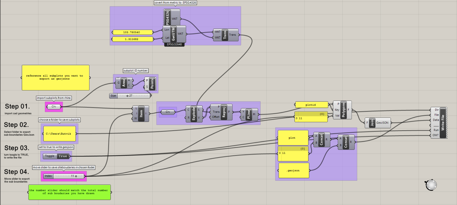
Import the polygon into the map platform as a GeoJSON file.
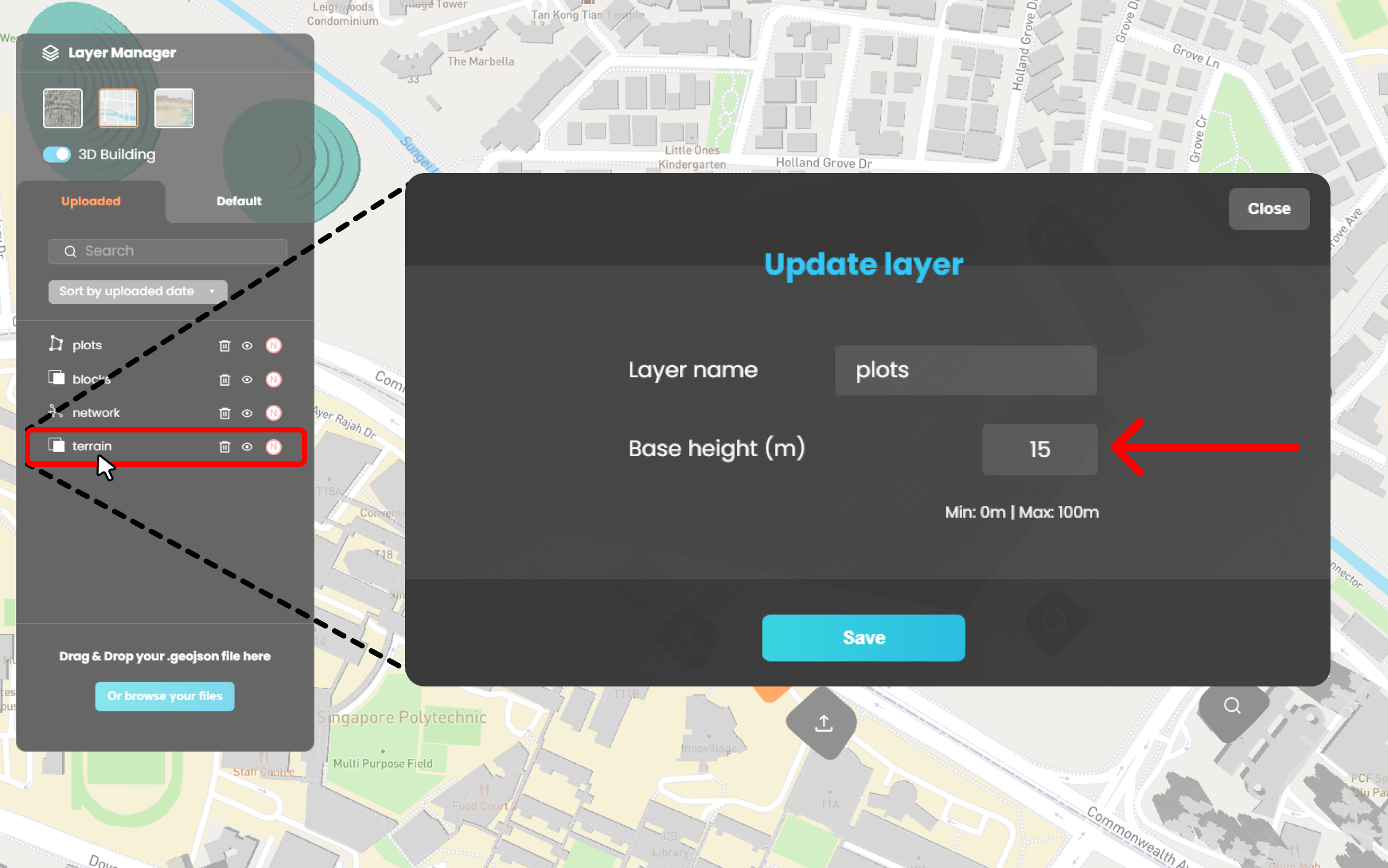
Double click on layer reveals popup to change name and elevation of uploaded solution. (Note: Elevation change is not available for the network.)
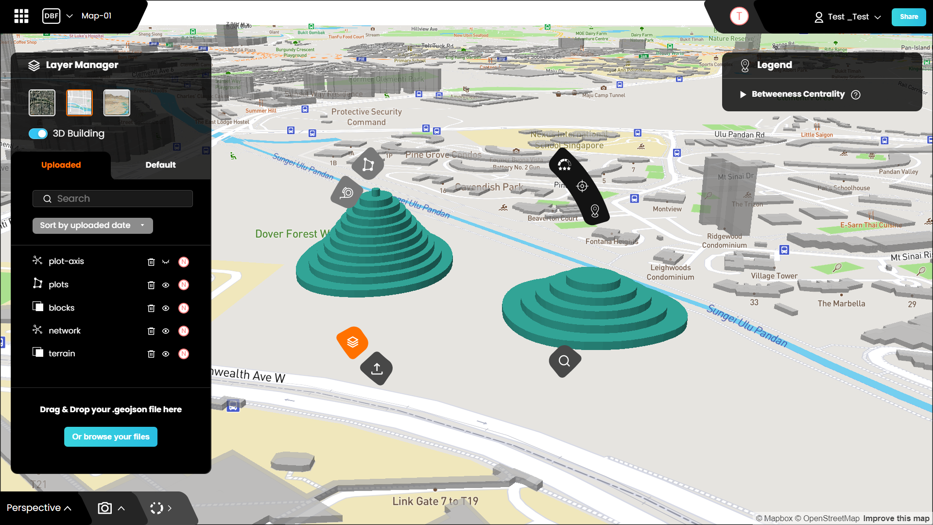
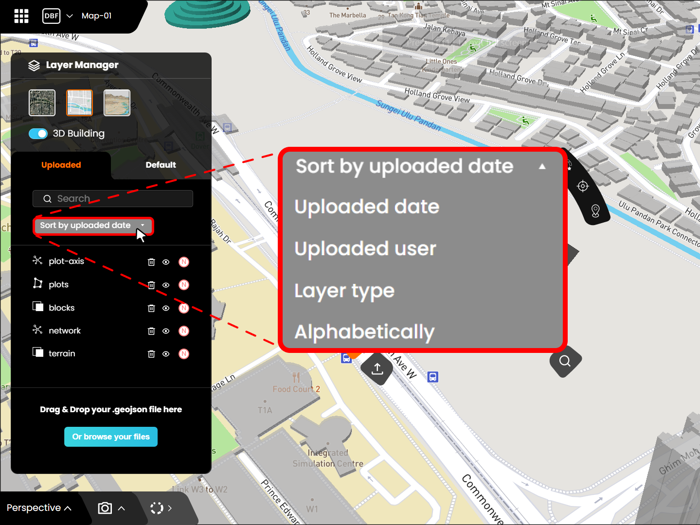
b. Sort data layers
- Click on the Sort by drop-down menu in the layer manager to sort the layers according to different parameters.
2. Network Uploads
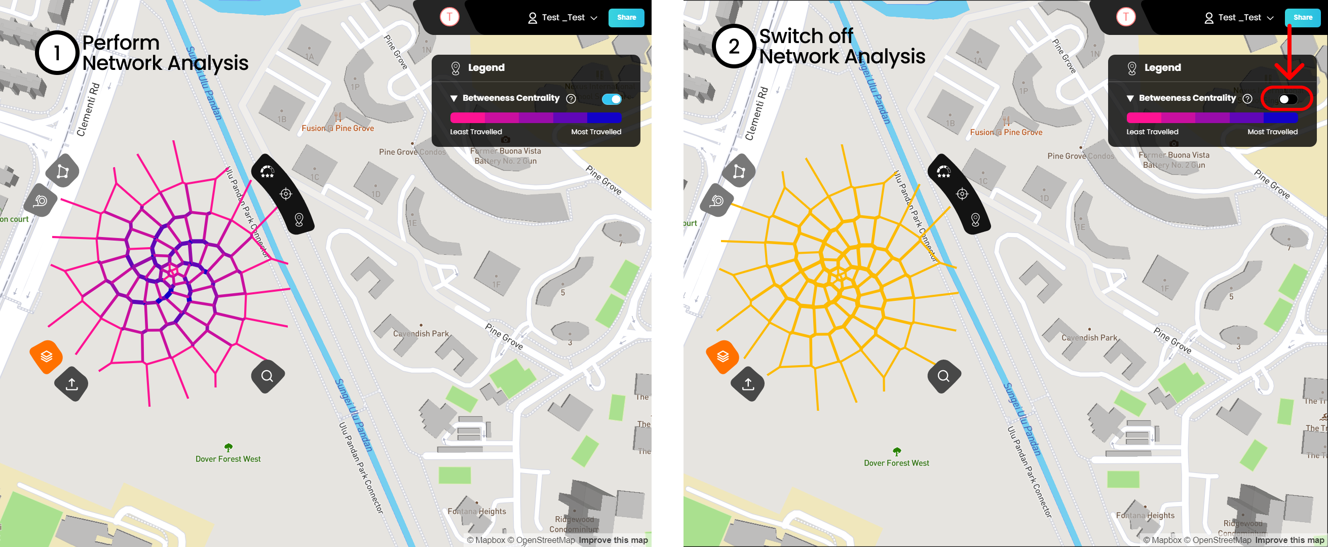
a. Imported networks can have custom colors (set in GH script).
b. Network analysis can be turned off by using the toggle in the legends panel.
The custom colors set up for the network can only be visualized once the network analysis is turned off.
3. Terrain Uploads
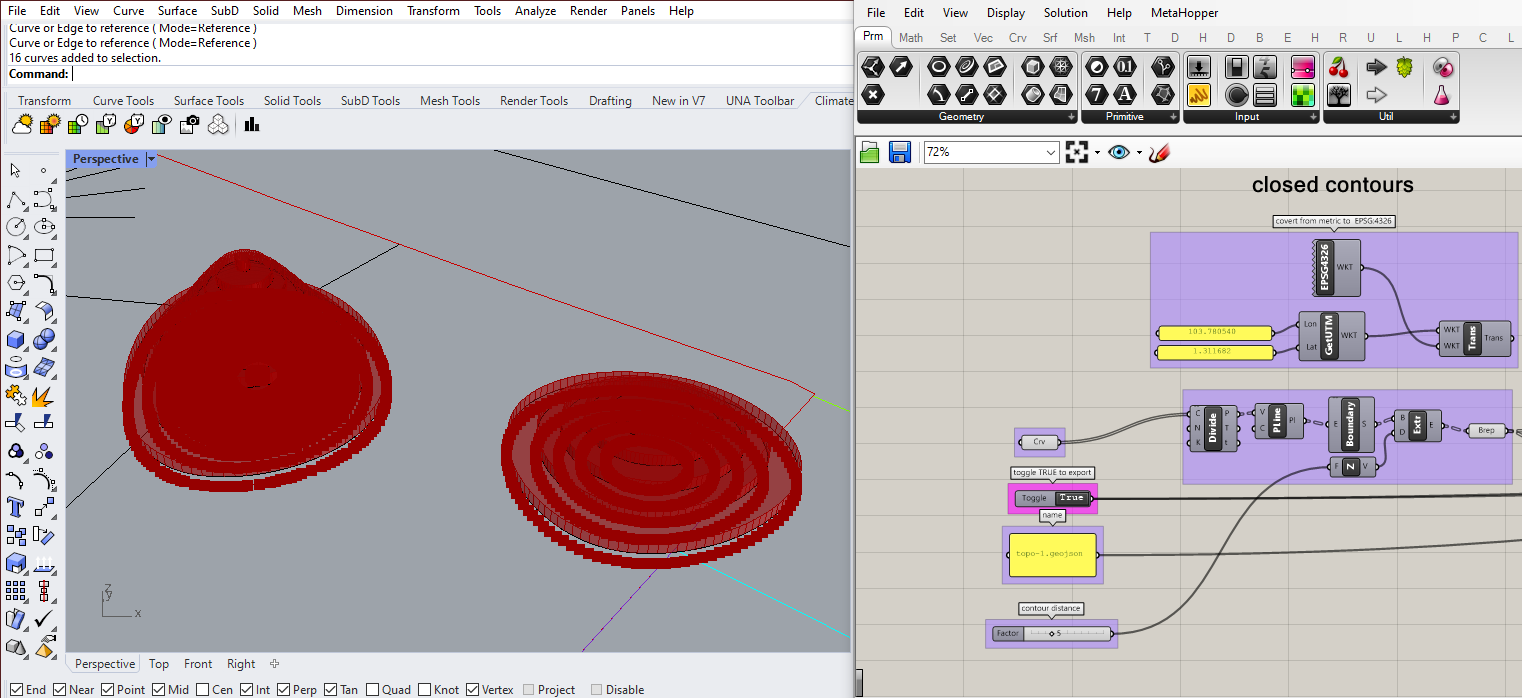
a. Terrain can be imported using contour lines
Create the contour lines using the given GH script
Export the contour with custom properties (colors, elevation, etc.)